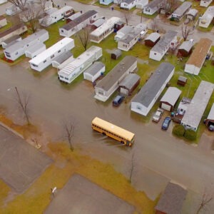
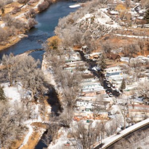
More than 6 million culverts in the United States channel water from streams and rivers under roads and away from homes, businesses, hospitals, and other critical facilities. However, nearly two-thirds of those culverts were built to standards insufficient for today’s storms. The result is widespread flooding when rainwater backs up behind undersized traditional culverts, overruns roads and highways, washes out bridges, and inundates neighborhoods.
Want research like this in your inbox?
Subscribe to our newsletter!
The financial and social costs can be staggering. When a culvert fails, it’s not just a road that’s lost—it’s a lifeline. Access to emergency services, schools, and jobs can be cut off for months. Recovery costs can easily far surpass the cost of building better infrastructure initially. Further, much of the costs of rebuilding fall on local taxpayers, pulling money from already stretched budgets.
The case of Hurricane Helene in North Carolina highlights the immense vulnerability of our stream crossings: 712 culverts and 674 bridges were damaged, leading to almost 1,500 road closures. The estimated transportation damages alone have exceeded $10 billion. Billions in damages caused by culvert failures have also occurred in Vermont, the Midwest, and Texas.
The good news is that this problem is fixable. By updating state and federal standards, we can guide the construction of durable, more effective culverts that better protect communities.

What are stream crossings?
The term “stream crossing” refers to structures designed to convey water, typically from streams and rivers, under a roadway, railway, or other embankment. This category includes culverts (e.g., pipes or box structures) and bridges. In the context of this analysis, the terms “stream crossing” and “culvert” are used interchangeably to refer to these structures, while excluding smaller installations such as driveway culverts placed along drainage ditches or temporary crossings.
Failing culverts and outdated designs are a nationwide problem
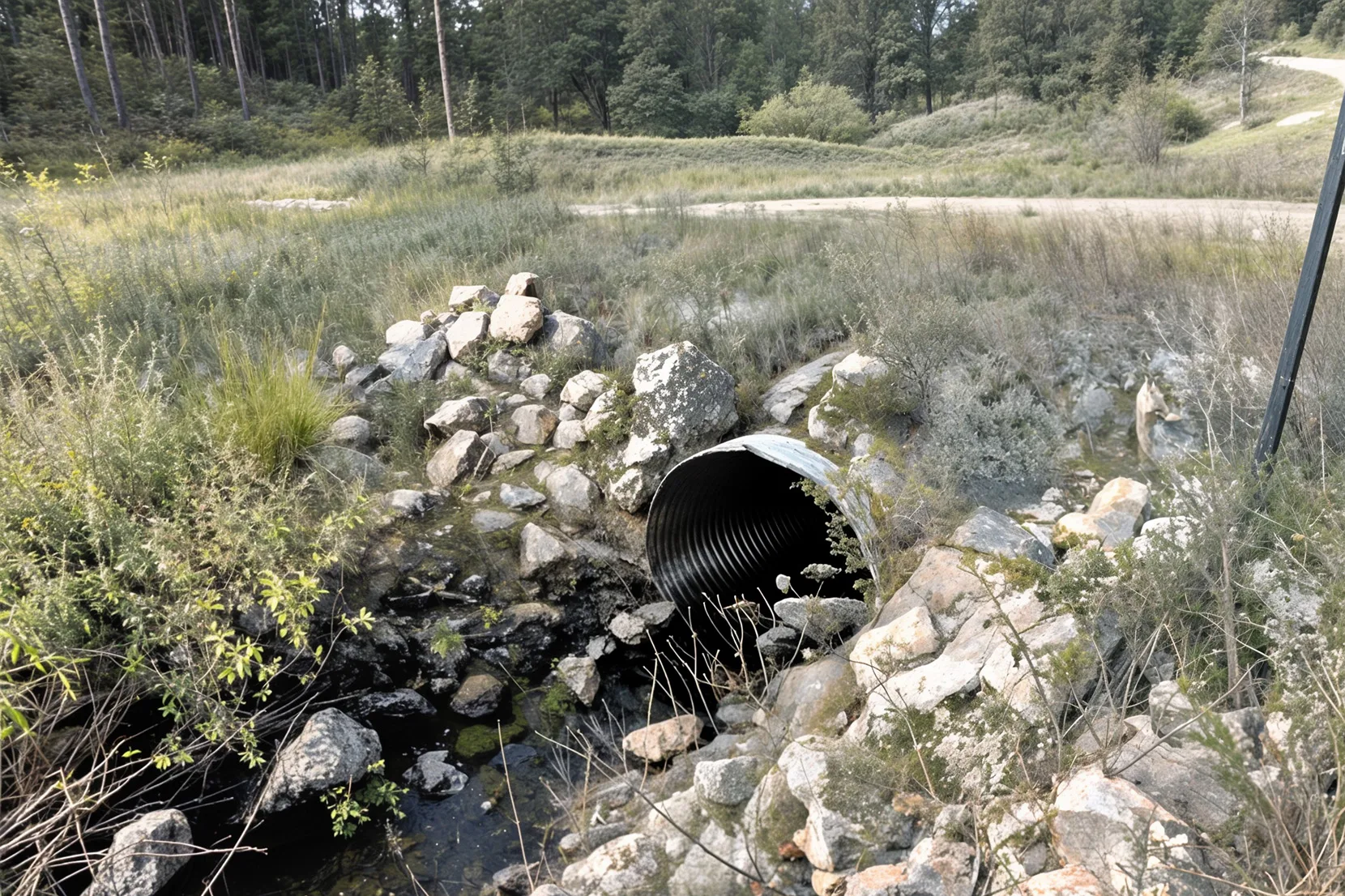
More than half of the country relies on design standards that use historic rainfall data and hydraulic calculations to determine the size and configuration of culverts. However, these data do not adequately account for severe weather events that can lead to flooding, clogging caused by woody debris, or the important ecological roles of sediment flow and fish movement. The traditional hydraulic approach often ignores a stream’s natural characteristics such as stream width, flow, and wood and sediment transport, which can lead to catastrophic failures during floods that endanger communities, degrade natural systems, and cause long-term economic liabilities.
According to the National Aquatic Barrier Inventory developed by The National Aquatic Connectivity Collaborative (NACC), there are nearly 6 million inventoried and mapped culverts in the United States. More than 3.5 million of those inventoried culverts (60%) are in states that have not adopted statewide stream crossing standards. The culvert inventory developed by NACC is still in development and is not comprehensive across all states, suggesting that the problem may be much larger than available data indicate.
In addition to the millions of existing culverts that are undersized and unable to handle expected flooding, in many places new culverts are being built to inadequate standards. An estimated 30 states are still employing outdated design standards for new culverts, unnecessarily increasing flood risk to communities. The five states with the most culverts and no statewide stream crossing standards are Texas (which alone has over 400,000 culverts), Arizona, Montana, New Mexico, and Nevada. Not every culvert in these states is inadequate, but the lack of a statewide standard means many of them are.
New culvert design standards offer better protection against flood damage
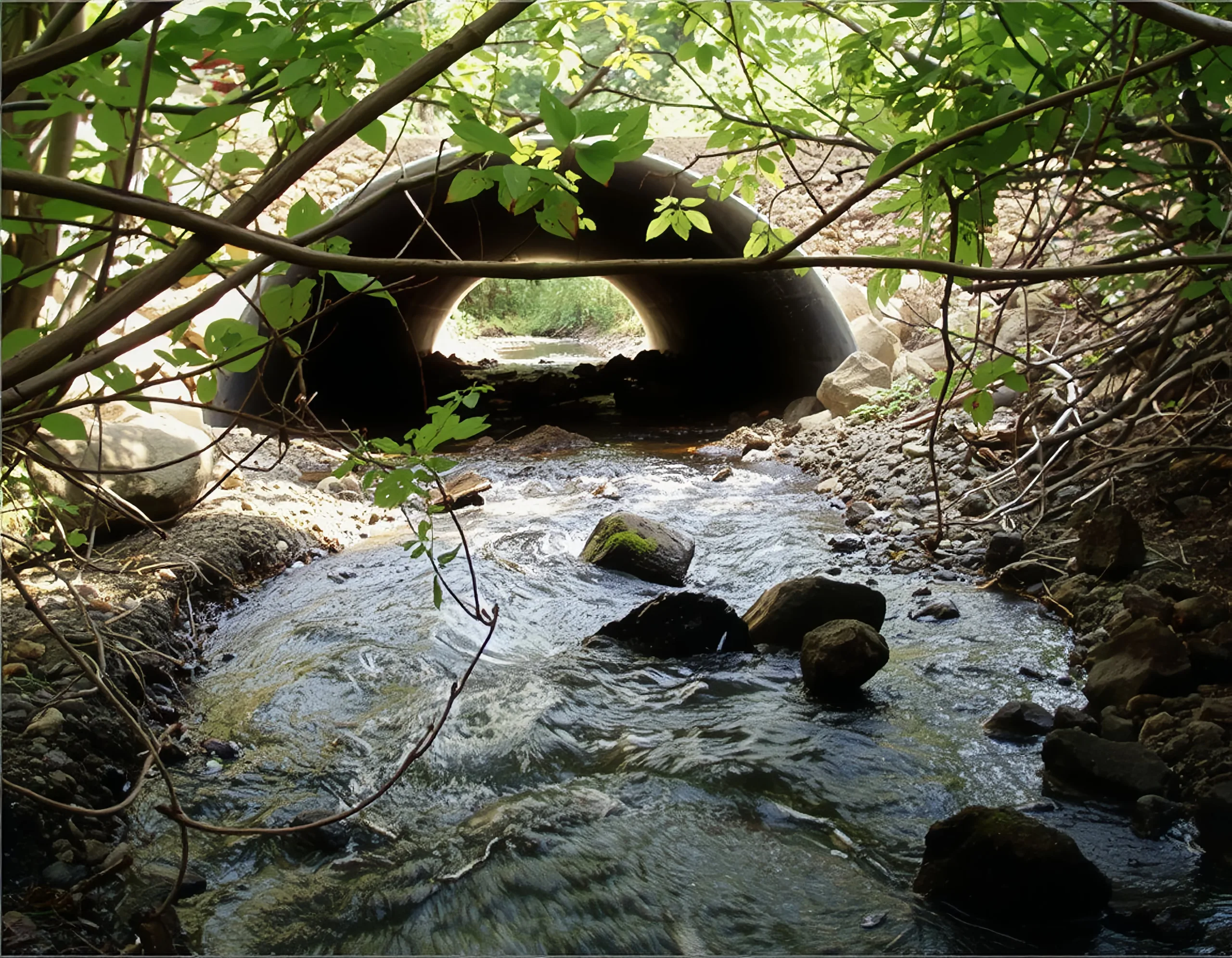
Fortunately, new standards known as “stream simulation culvert designs” can be used to construct culverts that offer more reliable flood protection.
Stream simulation culvert designs mimic the natural flow and function of a stream. These designs are based on factors that include the condition and dimensions of the stream, composition of the stream bed, and details about the landscape upstream and downstream from the culvert. The result is culvert construction that simulates natural streams and delivers multiple advantages such as fish and wildlife passage, long-term cost savings, and better performance during a flood.
Studies consistently show that stream simulation designed culverts handle floodwater far better than traditional culverts. While they cannot guarantee immunity from damages in future catastrophic storms, culverts configured with stream simulation principles have a much lower probability of failure during flood events. They are less likely to become clogged with debris, send flood waters over roads, or suffer complete failure when compared to traditional crossings.
Culverts that adhere to modern design standards can be more expensive to construct, sometimes increasing construction costs by up to one-third, but they also require less frequent maintenance and last longer (50-75 years versus 25-50 years). The long-term savings and potential avoided costs of a flood disaster make them a sound economic decision in nearly every case.
Several states are investing in these updated design standards. Washington and California have adopted stream simulation design requirements and run robust programs to replace undersized structures. But additional work is needed to remove barriers to upgrading culverts prone to failing during floods.
A labyrinth of regulations is holding up better stream crossings
Today’s regulatory environment and permitting process creates significant hurdles that discourage the implementation of better designed culverts. No single culvert standard applies nationwide, and culvert design standards vary among local, state, and federal agencies, all pursuing distinct objectives. This has resulted in at least three different design categories for stream crossings:
- Traditional hydraulic: This approach focuses on sizing culverts to a specific flow rate of water and is often driven by state departments of transportation to balance road safety with cost-effective construction.
- Aquatic Organism Passage (AOP): These designs prioritize sizing and streambed characteristics that ensure fish and other aquatic life can move freely through a culvert. This standard is championed by the U.S. Fish and Wildlife Service (USFWS) to meet its goals for ecosystem health.
- Stream Simulation Design: This is the most holistic approach that adopts methods to ensure water and fish can flow freely through a stream crossing. It aims to create crossings that are stable long term and allow the channel enough space to adjust to changing conditions, mimicking the natural stream. It was adopted by the U.S. Forest Service (USFS) in 2008 to reduce failure risk, maximize structure life, minimize maintenance, optimize safety, and provide fish passage.
Every stream crossing project must also comply with federal laws such as the Endangered Species Act, the Clean Water Act, and the National Flood Insurance Act, which are administered by different agencies. The regulations are often unclear about which specific design method to use, as they vary based on factors like the presence of protected species, whether the project is on federal land, whether it is receiving federal funding, or if it is located within a mapped special flood hazard area. This intersection of conflicting design philosophies and vague regulatory requirements creates a fragmented system in which different organizations follow different or overlapping guidelines, making a uniform approach nearly impossible.
For communities and local administrators, the lack of clear guidelines creates significant challenges in administering and enforcing requirements. More critically, this fragmentation and inconsistency increases project costs and delays timelines for designing, permitting, and constructing culverts.
While flexibility may sometimes be merited, more uniform stream simulation design standards—ideally established and clearly communicated at the state level—are needed. This clarity is essential to reduce project costs, streamline the permitting process, and accelerate the adoption of more effective, flood-ready stream crossings.
A path toward improving stream crossings and preventing flood damage
Several policy priorities at state and federal levels must be adjusted to guide more effective culvert design:
- Adopt statewide stream simulation design standards. Stream simulation design standards can provide communities with robust guidelines that reduce flood risk, allow for safe passage of fish, and improve the stream natural function. A unified state standard simplifies the current complex permitting and design process by incorporating the needs of all relevant interests (transportation, environment, flood resilience, aquatic species). This provides one consistent design approach instead of forcing communities to navigate and reconcile multiple, often conflicting, regulatory requirements. Several implementation and technical resources have been developed that state governments can use, including:
- the Mile High Flood Districts Geomorphically Informed Stream Crossing Structure design guidance;
- USFS Stream Simulation: An Ecological Approach to Providing Passage for Aquatic Organisms at Road-Stream Crossings; or
- stream simulation design state resources such as Washington’s Water Crossing Design Guidelines or Pennsylvania’s Stream Continuity Designs for Culvert and Bridge Crossings.
- Establish state-level inventories of culvert health. States should establish a consistent method for inventorying and assessing the condition of their culverts. This will allow for the prioritization of replacements and proactive maintenance, ensuring that the most vulnerable infrastructure is addressed first. In areas where federal, state, or municipal agencies are mandated to monitor culverts, the inventoried data should be shared across agencies.
- Fund stream simulation culvert construction. State and federal assistance should prioritize pre-disaster investments that prevent avoidable economic losses. Funding should be available to help communities upgrade to larger, more effective culverts before they fail.
- Implement culvert replacement programs. A systematic program is needed in every state to identify and replace at-risk culverts. Inadequate culverts in high flood risk areas should be replaced with stream simulation designs to prevent future issues and reduce long-term liabilities.
Upgrading standards for culverts is a strategic investment. It will protect more than just the environment. Stronger standards will safeguard people, investments in infrastructure, and the vitality of local economies.
Data Sources and Methods
Culvert data. There is no fully comprehensive, nationally consistent inventory of all culverts in the United States. For the purposes of this analysis, we used culvert data from the Southeast Aquatic Resources Partnership’s comprehensive Aquatic Barrier Inventory. This nationwide inventory actively collects information on all stream barriers, such as dams (including diversions, weirs, and low head dams), culverts, bridges, and other assessed road stream crossings. For this research, we downloaded all dams and road-related barriers, and then selected only those barriers that are identified as “culverts” or “assumed culverts.” Additionally, we filtered out all records that have been flagged as removed. While this is the most comprehensive culvert inventory currently available in the United States, it is still incomplete and data is not uniform between states. Therefore, the culverts included in this analysis are likely a conservative estimate.
Each culvert was spatially assigned to a U.S. state using a geographic overlay with the U.S. Census state boundaries. This allowed us to estimate a total count of culverts for every state.
Statewide stream crossing standards. For the purpose of this research, a state was identified as having “statewide stream crossing standards” if it has mandatory, statewide design regulations for either aquatic organism passage (AOP) or stream simulation in road-stream crossing construction and/or replacement. States with non-mandatory guidelines were not classified as having “stream crossing standards” for the purpose of this analysis.
It is important to note that neither AOP nor stream simulation standards are likely to apply to all waterways in a state. AOP requirements often apply solely to fish-bearing waters, while some stream simulation standards are specifically limited to perennial streams and exclude intermittent or ephemeral streams, as well as artificial ditches and drainage systems. Therefore, many crossings on smaller or nonperennial streams remain outside the scope of consistent standards, making the inventory presented here inherently limited.
Data regarding statewide stream crossing standards were compiled from the following five sources:
- Mile High Flood District. (2025). Geomorphically Informed Stream Crossing Structures. Lakewood, CO.
- U.S. Department of Transportation, Federal Highway Administration. (2024). Aquatic Organism Passage at Highway Crossings: An Implementation Guide. Washington, DC.
- Chesapeake Bay Program. (2020). Inventory of road-stream crossing guidelines and standards. Annapolis, MD.
- AASHTO Committee on the Environment and Sustainability. (2017). Long-term Construction and Maintenance Cost Comparison for Road Stream Crossings: Traditional Hydraulic Design vs. Aquatic Organism Passage Design. Washington, DC: American Association of State Highway and Transportation Officials.
- State regulatory research was conducted via online review of publicly available documents and agency websites from August through October 2025. If statewide stream crossing standards were not easily identified through publicly available documents, it was conservatively assumed that no such standards applied within that jurisdiction.