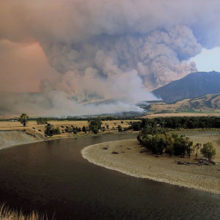
Wildfires today are larger, burn longer, cause more damage, and kill more people than ever before.
Measuring Communities Threatened by Wildfires
The map tool shows which communities in the U.S. have had nearby wildfires of more than 100 acres, from 2000 to 2017. The interactive tool displays communities as point locations. Distance measurements were calculated using Census Designated Place boundaries from the Census Cartographic Boundary shapefiles. Census Designated Places include both incorporated communities, such as cities, towns, and villages, and unincorporated communities.
The tool analyzes the proximity of communities to wildfires of more than 100 acres in size as published by the Geospatial Multi-Agency Coordination Group, or GeoMAC, in its “US Historic Wildfire Perimeters” GIS layer. Importantly, the GeoMAC “US Historic Wildfire Perimeters” layer only contains perimeter data submitted by field offices. While GeoMAC makes every effort to provide accurate and complete information there are gaps in coverage, particularly for smaller and less destructive wildfires.
This map tool is not a predictive model of wildfire potential or probability. It is designed only to show where wildfires occurred from 2000-2017 using GeoMAC’s published database with GIS perimeters of wildfires. Not shown are wildfires of less than 100 acres, wildfires that occurred but were not recorded in the data, or wildfires that occurred previous to 2000 or since 2017.
CPAW: Communities Reduce Wildfire Risk Through Land Use Planning
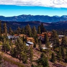
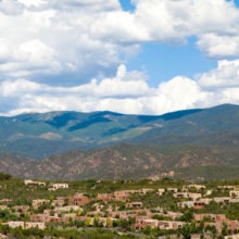
The rapid pace of new development in the wildland-urban interface (WUI), where more than half of all new homes are constructed, puts lives and property directly in the path of danger. Better land use planning can reduce the consequences of wildfire by helping communities identify where and how to build safely.
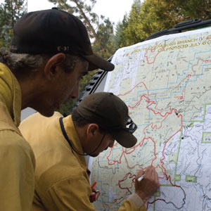
To help communities improve land use planning strategies for wildfire, Headwaters Economics and Wildfire Planning International created the Community Planning Assistance for Wildfire (CPAW) program in 2015.
CPAW provides communities with multi-disciplinary teams, which include land use planners, foresters, researchers and policy analysts, to provide customized, technical land use planning assistance. Teams collaborate with communities to provide assistance, including land use planning support and recommendations, training and capacity building, risk assessments, and specialized research and science.
The Community Planning Assistance for Wildfire program announced that four new communities will join 26 others in the CPAW program in 2019. The communities are Gunnison County, Colorado; Mariposa County, California; Pinetop-Lakeside, Arizona; and Redding, California.
Over the course of one year, the CPAW program will provide customized assistance to these communities including land use planning recommendations, training and capacity building, and specialized research. Gunnison County and Pinetop-Lakeside will also receive wildfire hazard assessments in partnership with the Rocky Mountain Research Station. All communities will receive ongoing implementation support, networking with other CPAW communities, and data and science as needed and as funding allows.
Learn more in the CPAW community profiles.
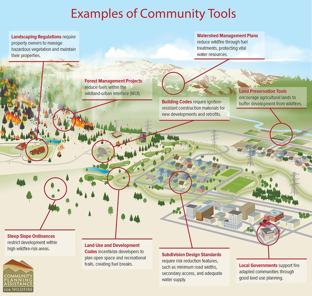
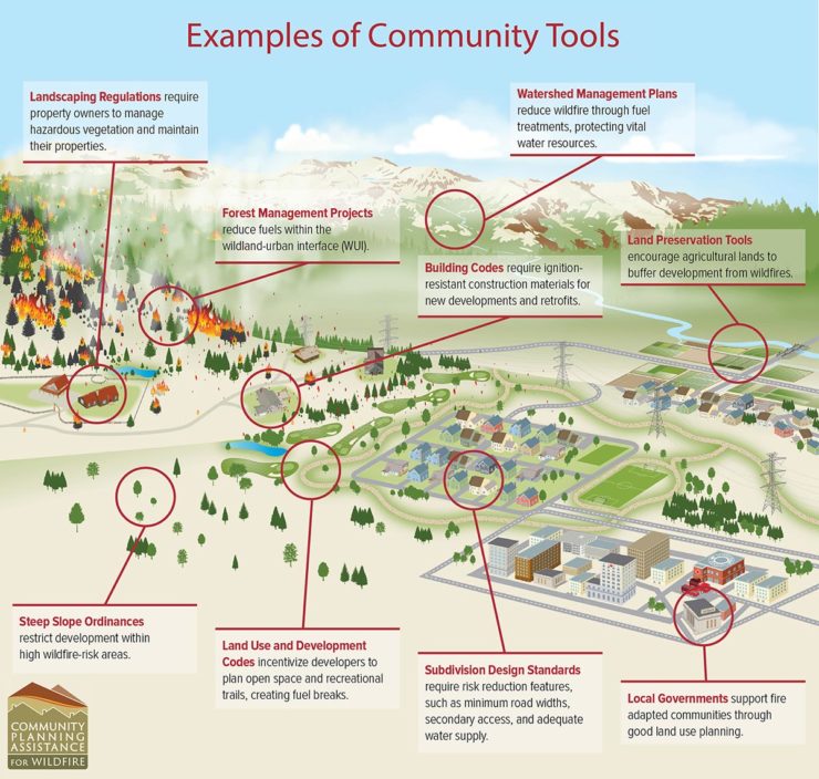
Examples of Land Use Tools to Help Communities Reduce Wildfire Risk
Land use planning tools to reduce wildfire risk are diverse and can help communities design where to allow development, what building materials will help keep people safe, and what infrastructures is needed to safely respond when disasters strike.
For example, subdivision design standards in wildfire-prone areas may require risk reduction features such as minimum road widths, secondary access, and adequate water supply.
Building codes for structures in the wildland-urban interface may require ignition-resistant construction materials, and landscaping regulations may require landowners to manage flammable vegetation within a certain distance of structures.
Recommendations developed through CPAW are tailored to each community’s unique conditions including wildfire risk, development trends, and regulatory framework. Recommendations are developed after extensive review of community documents, ongoing stakeholder engagement, and multiple on-site assessments.
CPAW also works brings together land use planners and fire personnel from at-risk communities for peer-to-peer learning through several workshops and trainings each year.
Implementation of recommendations is voluntary and under the authority of the local jurisdiction. All CPAW services come at no cost to the community. CPAW is funded through cooperative agreements with the U.S. Forest Service, the LOR Foundation, and other private foundations.
As risk is amplified by the converging forces of increasing wildfires and growing communities expanding into the wildland-urban interface, the challenge of living safely increases. Land use planning tools are necessary and effective at reducing risk and cost.