Communities threatened by wildfires, 2000-2019
- Nearly 2,000 communities saw a wildfire of 100+ acres burn within two miles between 2000 and 2019.
- Nine cities with more than 500,000 residents have been threatened by wildfires.
- Most homes are lost or damaged due to embers, which can travel a mile or more ahead of a wildfire front.
- Communities can increase wildfire resiliency by hardening homes to ember ignitions.
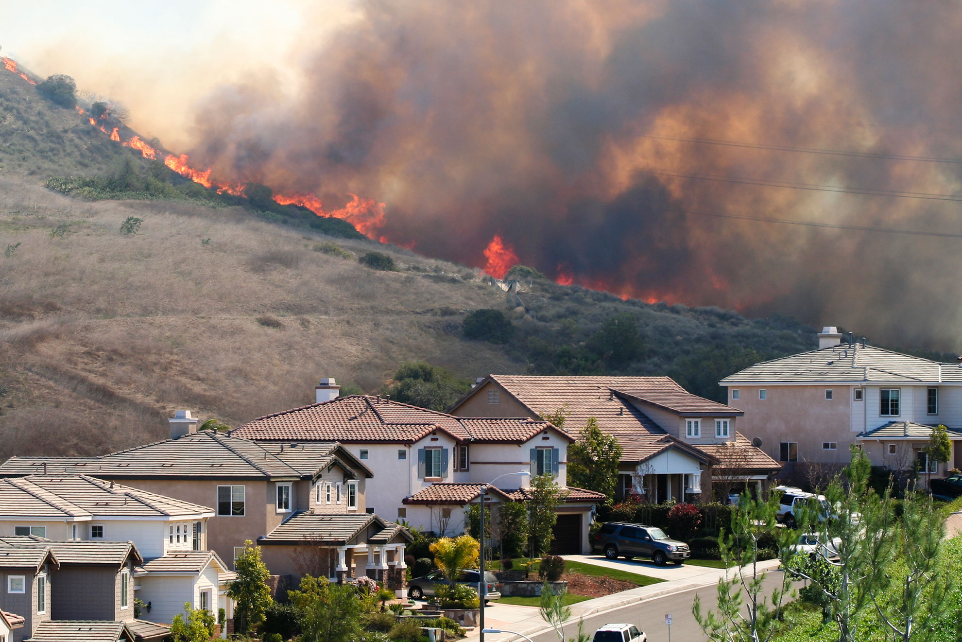
Our spatial analysis of historic wildfire perimeters shows that between 2000 and 2019 nearly 2,000 communities were threatened by wildfires (100+ acres) burning within two miles of town. Many communities have experienced repeated threats from wildfires, such as Los Angeles, CA, which has had 41 wildfires burn close to city limits since 2000.
Many other large cities across the country have been similarly threatened by nearby burning wildfires—including Houston, San Diego, Las Vegas, Jacksonville, and New York—resulting in the evacuation of hundreds of thousands of people.
It is often assumed that wildfire disasters and related home losses are a result of a large wildfire front, yet it is the much less conspicuous embers that destroy homes.
The risk of home loss increases as a wildfire approaches a community and as the fire grows in size and intensity. Within one mile of the community, indirect exposure from embers becomes a significant concern.
Knowing which communities have experienced historic wildfires close to town and understanding the role of embers in home destruction during a wildfire can help identify frequently impacted areas. Communities at high risk to wildfires need to consider adaptive planning efforts focused on living with the inevitability of wildfires.
Embers Are the Primary Threat to Homes
During a wildfire, embers—also known as firebrands—can travel nearly a mile ahead of the wildfire front. The embers land on various surfaces and if those surfaces are vulnerable to ignition (such as dry vegetation, debris, wood, and other combustible material), the embers can grow into individual spot fires.
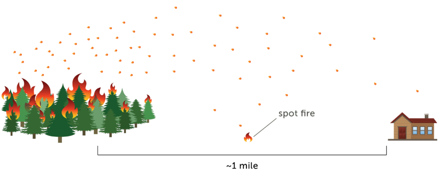
Given enough fuel, the spot fires increase in size and intensity and ultimately threaten to burn down the home. A single burning structure can result in home-to-home ignitions and threaten an entire neighborhood. Once multiple homes are ignited, firefighter responses can be quickly overwhelmed and a wildfire disaster can occur.
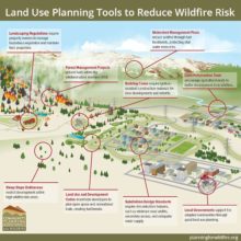
The sequence of a wildfire disaster can be broken by the home ignition zone (HIZ)—the home’s materials, design, and maintenance in relation to its immediate (100’) surroundings. Reducing opportunities for embers to ignite within the HIZ correspondingly reduce the potential for the home itself to burn as well as the surrounding neighborhood.
Overcoming popular perceptions that wildfire disasters are a wildfire control problem rather than a home ignition problem determined by the HIZ will reduce home loss. By focusing on the home itself—including building materials, design, and layout—as well as the immediate characteristics surrounding the home such as landscaping and terrain, community wildfire resiliency is increased.


Community Planning Assistance for Wildfire
Community Planning Assistance for Wildfire (CPAW) works with communities to reduce wildfire risk through improved land use planning. The program is a program of Headwaters Economics, in partnership with the USDA Forest Service.
Methods and data sources
The map tool shows which U.S. communities have experienced wildfires (100+ acres) within 2 miles of town between 2000 and 2019. The interactive tool displays communities as point locations. Distance measurements were calculated using Census Designated Place boundaries from the Census Cartographic Boundary shapefiles. Census Designated Places include both incorporated communities, such as cities, towns, and villages, and unincorporated communities.
The tool analyzes the proximity of communities to wildfires of more than 100 acres in size as published by the National Interagency Fire Center (NIFC) in its “U.S. Historic Wildfire Perimeters” GIS layer. Importantly, the historic wildfire perimeters only contain data submitted by field offices. Gaps in coverage may exist, particularly for smaller and less destructive wildfires.
This map tool is not a predictive model of wildfire potential or probability. It is designed only to show where wildfires occurred from 2000-2019 using NIFC’s published database with GIS perimeters of wildfires. Not shown are wildfires of fewer than 100 acres, wildfires that occurred but were not recorded in the data, or wildfires that occurred previous to 2000 or since 2019.
This post updates a previous post and visualization from April 2018.