New program to reduce flood risk in rural communities
Pilot project in Three Forks, MT
The risk of flooding is underestimated in communities throughout the United States. While flood maps are key tools for assessing risk, they are not available for two-thirds of the country’s rivers and streams according to a recent report published by the Association of State Floodplain Managers. Further, better data and maps are insufficient to address flood risk unless they are accompanied by resources and support at the local level. Improved flood risk data falls short if communities lack the capacity to use this data to decrease their vulnerability.
Why we wrote this: Flood risk is underestimated in the United States, but better maps and data are not enough to help communities. They must be accompanied with resources to support local action.
In 2020 Headwaters Economics launched a new program to reduce flood risk with a pilot project in Three Forks, Montana. Updated floodplain maps in Three Forks demonstrate that flood risk was previously underestimated, potentially devastating the local economy and sense of community. However, when communities are supported with strategic capacity-building, these moments of crisis can enable innovative, forward-thinking projects to increase community resilience.
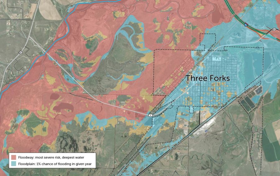
Proposed floodplain maps for Three Forks, MT show greater risk
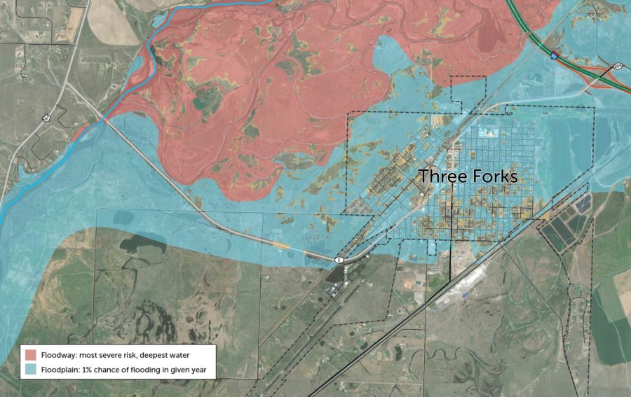
Left: Current FEMA regulatory floodplain map.
Right: Proposed FEMA regulatory floodplain map.
Flood potential could limit economic development and trigger sprawl
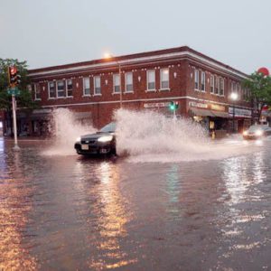
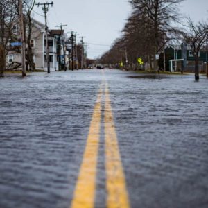
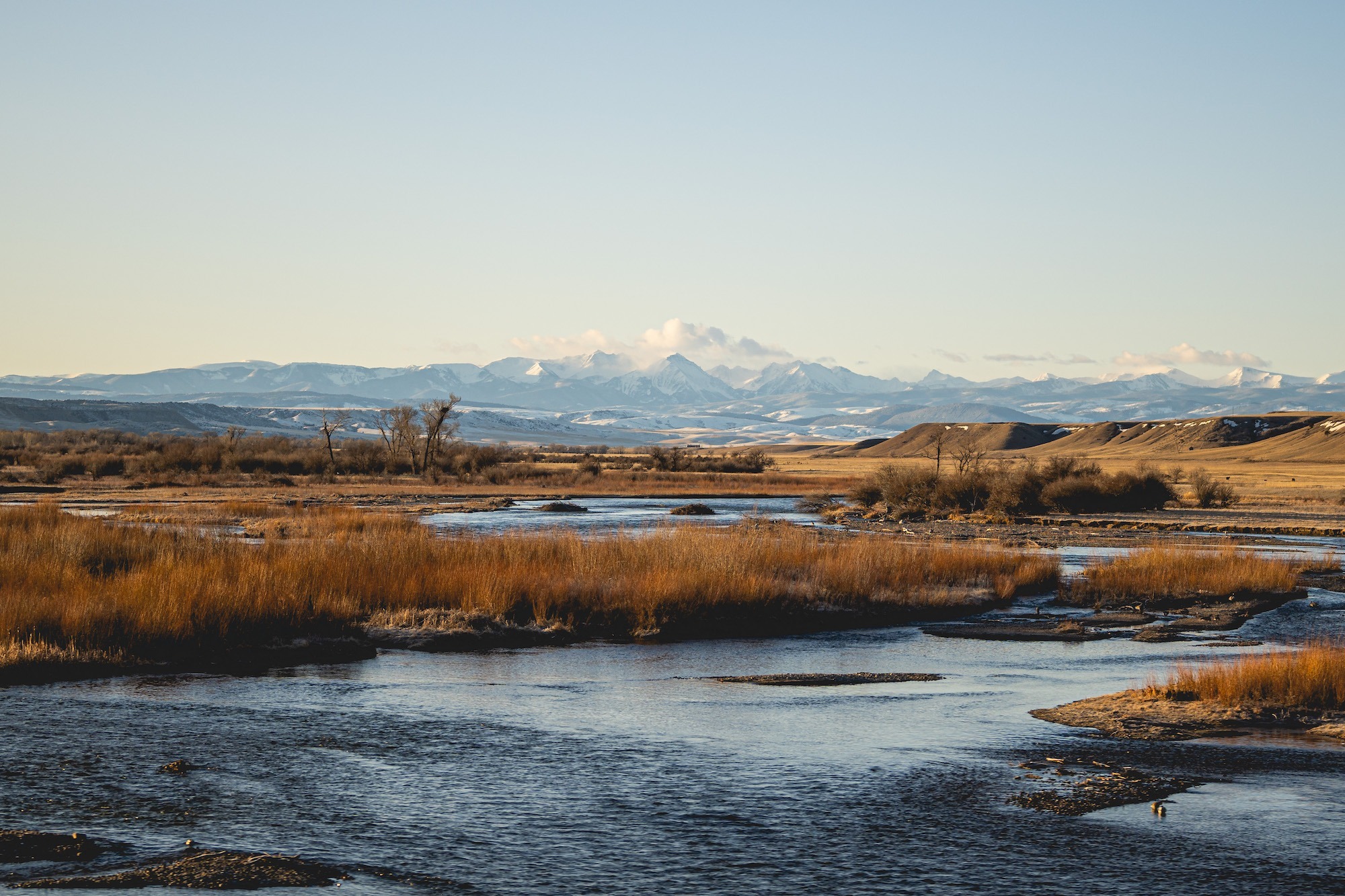
Three Forks is a rural community of almost 2,000 people in southwestern Montana. It sits at the headwaters of the Missouri River where the Gallatin, Madison, and Jefferson rivers converge.
While the city has long acknowledged its flooding risk, the updated maps, part of a recent watershed flood mapping process, demonstrate that the city’s flood risk is far higher than previously understood: the majority of the city is in the 100-year floodplain and its western sections are now categorized as the floodway. A major flood could cause between $62 and $109 million in damages to the city’s residential structures.
What’s the floodplain?
The Federal Emergency Management Agency (FEMA) designates areas that are prone to flooding as floodplains. Land that is in the “100-year floodplain” has a 1% chance of flooding in any given year. Put another way, these areas have at least a 1-in-4 chance of flooding during a 30-year mortgage. Building is typically allowed in the floodplain (outside of the floodway), but special permits and flood insurance are often required. Within a floodplain, the floodway is the land that is expected to have the highest water depths during flood events. These areas are typically restricted from any future development.
When these maps are approved by FEMA, the proposed floodplain maps of Three Forks would require more residents to purchase flood insurance and would impose severe development regulations. Both the risk and the associated regulations may limit the City’s ability to attract new residents and businesses, threatening future growth and economic opportunities.
Three Forks is positioned for growth. It is located in Gallatin County, the fastest-growing county in Montana. From 1990 to 2018, the number of single-family homes in Three Forks increased by 46% according to tax assessor records maintained by the Montana Department of Revenue’s Property Assessment Division.
The vision that Three Forks has established encourages in-town development. However, recent development pressures could create undesired outcomes if large swaths of the city are no longer suitable for development because of the flood risk. Newcomers would be more likely to develop outside of city limits, contributing to county sprawl. Home development outside of city limits can burden municipal budgets as rural residents use city infrastructure and services but do not pay property taxes inside the city’s jurisdiction.
Increasing community capacity to reduce flood risk
Flood maps have social and economic implications at the local level that cannot be ignored. In communities where flood risk has historically been underestimated, improved floodplain data can create despair and even anger when communities do not see an obvious solution to address the risk.
As a small, rural community, Three Forks had limited staff time and funds to address its flood risk. Crystal Turner, the City Clerk for Three Forks, reflected after hearing about the new floodplain maps, “I get teary even thinking about the devastation that could become our community.”
“I get teary even thinking about the devastation that could become our community.”
Crystal Turner | City Clerk for Three Forks
Three Forks was at a critical moment. The city was highly motivated to act but needed additional capacity. In response, Headwaters Economics partnered with the City of Three Forks, the Montana Department of Natural Resources, and Great West Engineering to develop a project to decrease the city’s flood risk. The team helped the city assess possible solutions, select a project and identify a funding strategy, and submit a grant to FEMA to help fund the project.
Realizing a new future for the City
The proposed mitigation project is an innovative, nature-based solution that is designed to divert and convey flood waters into a storage pond and then back into the river. The project’s conveyance channel will be built by widening and deepening historic river channels west of the city. The project will also enhance an existing pond, which will provide additional water storage for the Three Forks Rural Fire District.
Mitigation would greatly reduce risk in Three Forks
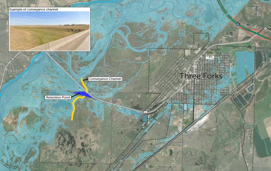
Hydraulic models show that mitigation would greatly decrease the Jefferson River floodplain. Data showing the impacts of mitigation to the Madison River floodplain are not yet available. Post-mitigation, some areas in northeast Three Forks may still be in the floodplain.
Initial modeling by Great West Engineering demonstrates that the mitigation project’s conveyance channel and retention pond will have significant benefits for Three Forks. The map above estimates how the project will decrease the Jefferson River floodplain within city limits. This map is tentative as landowner easements are still being negotiated and revised floodplain maps will need to be approved by FEMA.
The project is expected to cost approximately $5 million. It will protect residents, houses, infrastructure, and critical facilities such as the fire and ambulance halls, an assisted living home, and the Three Forks Public School from a significant flood.
What’s next for the flood program
Three Forks is the pilot project for the new flood program at Headwaters Economics. The program is designed to provide technical assistance to communities, free of charge and tailored to meet their needs.
We partner with communities to decrease flood risk by:
- helping communities prioritize their mitigation options and develop funding strategies;
- providing assistance and building capacity at critical times; and
- conducting customized research to answer community questions.
The team at Headwaters Economics works on-the-ground with communities, offering help with engineering, planning, grant writing, and outreach. In 2021 Headwaters Economics is expanding its flood program to additional communities in the Midwest.

If you are interested in having your community join this program, contact Kristin Smith.