Land use planning can reduce wildfire risk to homes and communities
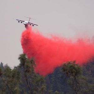
- Wildfires are increasing. Attempting to extinguish all wildfires is costly, dangerous, and unrealistic.
- Building a home with wildfire in mind can increase a home’s survivability.
- Land use planning can help communities become fire-adapted and resilient in the face of increasing wildfire potential.
Overview
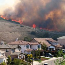
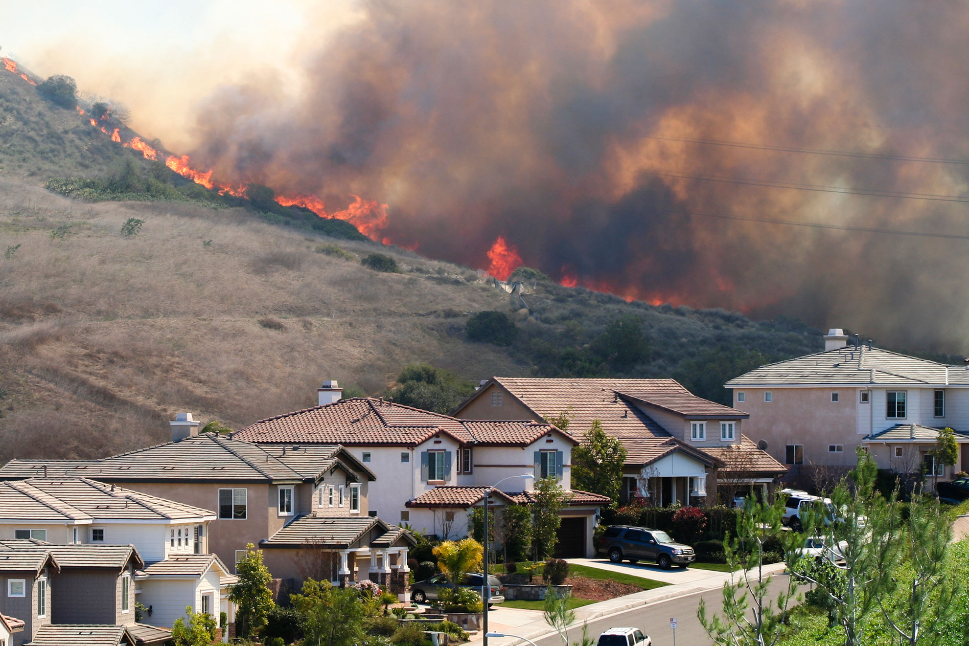
Wildfire risk to people and homes is increasing. While climate change and decades of fuel buildup have exacerbated wildfires, ongoing home development in wildfire-prone lands is also driving wildfire risks to communities.
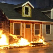
Building a home with wildfire in mind can increase a home’s survivability. Using wildfire-resistant building materials in the construction of a home can reduce vulnerabilities and opportunities for ignition. Additionally, managing the vegetation immediately surrounding the home—known as the home ignition zone (HIZ)— reduces the potential for a home to ignite during a wildfire.
In areas with high wildfire hazard, land use planning can reduce wildfire risks to homes and communities by requiring new developments to comply with wildfire-resistant design and building techniques.
This post is based on an article originally published in the Idaho Law Review, Volume 55(1). Also read this companion post about the history behind federal wildfire policy.
Understanding the risk to homes
Media narratives often portray wildfire as a disastrous inferno, yet the real culprits of home loss and community devastation are the much less dramatic embers flying well in advance of a wildfire front.
Embers are responsible for up to 90% of home destruction during a wildfire. Landing on flammable materials—such as dry shrubs, wood roofs and decks, and firewood piles—the small ignition points quickly spread and become larger individual spot fires. In turn, the multitude of spot fires grow, amassing and intensifying, and then together with quick-moving surface fires, they directly threaten to destroy the home.
Recognizing that a home burns down from embers and not an all-consuming wildfire front simplifies the challenge of creating fire-adapted communities by rescaling our frame of reference. In scaling down to the individual structure, mitigation measures are directed at the first 100 feet between a building’s edge and property boundary. By reducing potential ignition vulnerabilities within the 100-foot buffer—known commonly as the Home Ignition Zone—as well as the home itself, chances of survivability during a wildfire greatly increase.
Enhancing the wildfire-resistance of individual homes is therefore a fundamental consideration in creating entire communities better adapted to living alongside wildfire. Building a home to higher wildfire-resistant standards reduces opportunities for home-to-home ignitions and better equips the larger neighborhood to withstand a wildfire. As a result, firefighters can focus on individual home ignitions rather than being overwhelmed by multiple homes simultaneously burning, which can lead to larger and more disastrous urban conflagrations.
Subscribe to our newsletter!
Planning for inevitable wildfires
A natural part of ecosystems, wildfires are inevitable. But as extreme and large wildfires become more common, wildfire suppression will be less effective. Communities must consider how, where, and under what conditions development in high wildfire hazard areas occurs.
Creating homes and communities better adapted to wildfires requires a judicious and anticipatory approach in land use planning. Through the use of plans, regulations, building codes, and other land use planning measures, wildfire mitigation can be wedded to the community’s larger goals for growth, sustainability, and resilience.
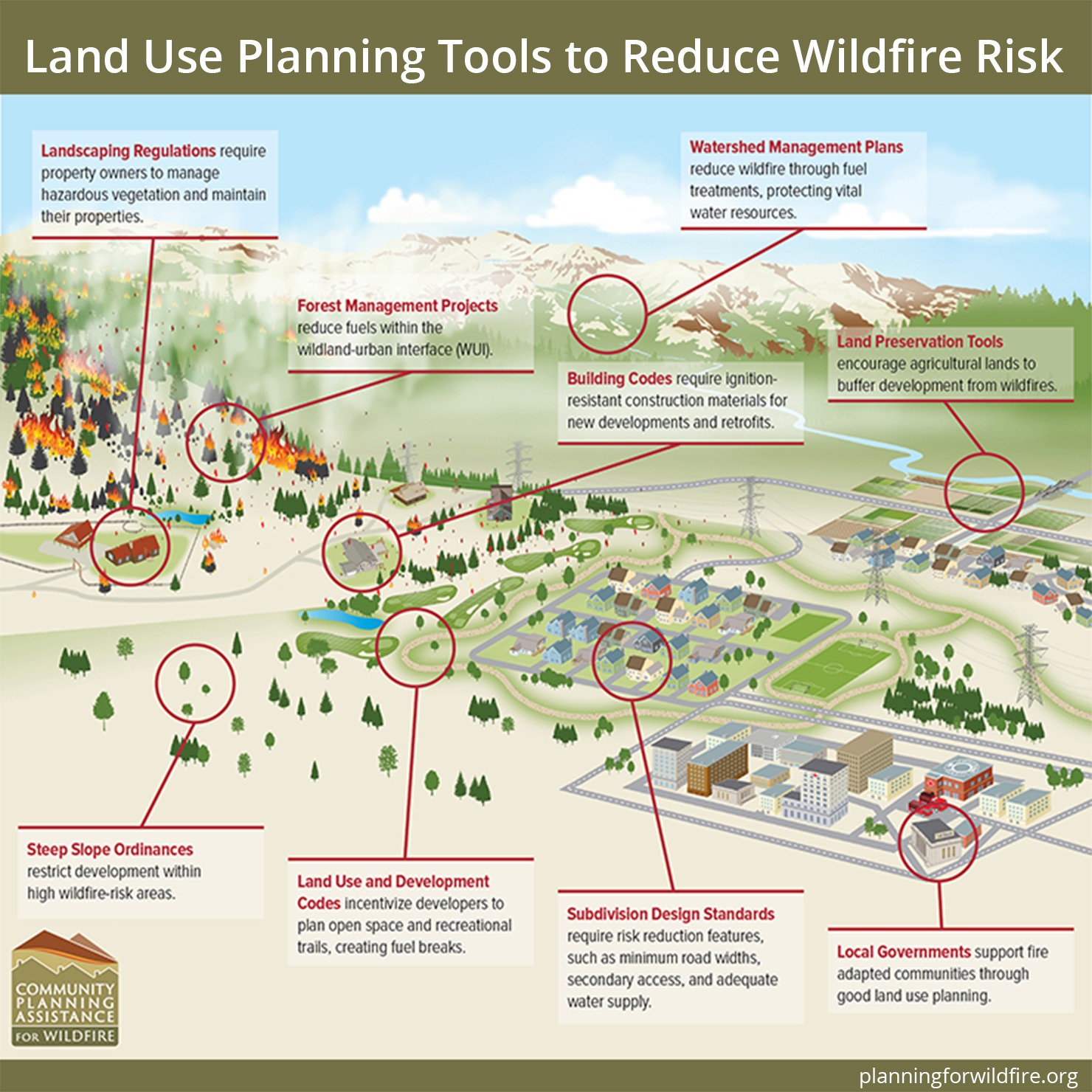
Community Plans and Policies
A community’s vision for growth is guided by a variety of development plans. The comprehensive plan, or master plan, provides the foundation for long-term development while other plans provide guidance on specific objectives. Wildfire risk can be factored into community development through growth policies and strategies identified in the comprehensive plan. Because the comprehensive plan is the political framework for future growth in the community, integrating wildfire into the document reaffirms the legal basis for protecting community assets, values, and resources from wildfire impacts.
A Community Wildfire Protection Plan (CWPP) is a planning document addressing wildfire risk and is built on the values of public safety and community welfare outlined in the comprehensive plan. To comply with the Healthy Forests Restoration Act (HFRA 2003), CWPPs must contain three elements:
- partnerships among agencies, public organizations, and private citizens;
- fuel treatments to reduce hazardous fuels; and
- strategies to reduce the ignitability of structures.
Developing a CWPP provides a unique opportunity for collaboration among a broad range of stakeholders and catalyzes discussion around shared wildfire concerns. Communities that successfully complete CWPPs are eligible for federal funding to reduce hazardous fuels.
Although community plans are nonregulatory, they demonstrate a town or city’s intentions for growth, safety, and sustainability. Requiring forward-thinking principles, community plans empower communities to protect critical infrastructure, assets, and resources. In considering wildfire risk within this context, other synergies and areas of interest are identified such as preservation of open space, adequate transportation services, water quality, and protection of scenic and natural values.


Example: Boulder County, Colorado
Boulder County, Colorado’s, comprehensive plan was amended in 2017 and dedicates an entire section of the natural hazards chapter to wildfires. While the document acknowledges the importance and environmental benefits of wildfires, it also outlines several policies to minimize impacts to homes and communities. Specifically, the comprehensive plan stipulates that during the review of proposed developments in areas at high wildfire risk, site elements such as location, building construction and design, landscaping, fuel management, access, and water availability have to be adequately addressed.
Regulations
Key components of the comprehensive plan are implemented through regulatory tools such as zoning, subdivision ordinances, and building codes. A variety of regulatory measures allows city and county governments to select options that best reflect site-specific wildfire concerns that align with broader community objectives.
Zoning is one of the more robust and common land use planning tools regulating development. Zoning stipulates the type of land use permitted and the intensity of development within individual districts, such as commercial, residential, and agricultural.
While there are many different types of zoning districts, an overlay zoning district can be used to mitigate wildfire risk by placing additional regulations within an area of special concern. Overlay zones can be applied to ensure public safety is maintained, such as around airports or floodplains, and to preserve the aesthetic character of a place, such as a historic building or neighborhood. Specifications within the overlay district often supersede the existing zoning standards.
Subdivision regulations are another land use planning tool to reduce wildfire risk. By stipulating the pattern and layout of new developments, subdivision regulations can mitigate wildfire impacts by requiring multiple accesses, sufficient water supply, vegetation control, and setback distances, for example.
Subdivision regulations can also specify home construction materials. Also addressed through building codes, the construction and design of homes in high-wildfire-risk areas can require ignition-resistant building materials. Key components of the home that are traditionally vulnerable to wildfires—such as the roof, decking, windows, doors, and siding—can be constructed with ignition-resistant products.
A recent report by Headwaters Economics found that building a home to ignition-resistant standards costs roughly the same as building a more traditional, combustible home, and it provided long-term benefits such as durability and minimal maintenance.
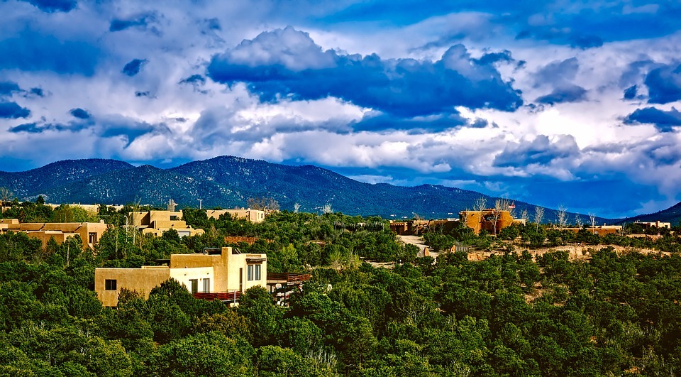

Example: Santa Fe, New Mexico
In Santa Fe, New Mexico, an overlay district has been applied to the city’s escarpment zone. The original intent of the overlay zone was to limit future development along the ridgetops and foothills. More recently, the overlay zone also mitigates wildfire risks through enforced home design standards and landscaping requirements. For example, homeowners living in the overlay district are only allowed to landscape with fire-resistant vegetation, and the city is permitted to routinely thin trees to reduce potential fuels. To ensure compliance, individual site assessments are conducted by the city’s land use planning department, which works closely with the local fire department and WUI mitigation specialist on enforcement. The overlay district is also mapped and updated to reflect changes in land cover, land ownership, and new housing.
Building and WildIand-Urban Interface (WUI) Codes
Building codes are regulations that govern the design, construction, and maintenance of structures. Local jurisdictions commonly adopt model building codes maintained by the International Code Council (ICC) and then amend the codes to better fit the needs of the city, county, or state. In 2003, the ICC released the first International WUI Code (IWUIC) with the aim of mitigating wildfire hazard to life and property and preventing structure fires from spreading to wildland fuels. Every three years, IWUIC is updated and amended based on recent wildfire science and knowledge. The WUI code can be integrated into building and fire codes as well as public education programs.
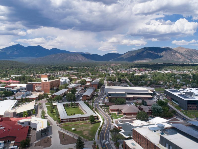
Example: Flagstaff, Arizona
In 2008, Flagstaff, Arizona, adopted the IWUIC with local amendments. Wildfire risk in Flagstaff is prevalent due to its location amid one of the world’s largest contiguous ponderosa pine forests. For instance, in 2010, the Schultz Fire devastated the community and resulted in suppression and post-fire costs totaling more than $130 million. The process of Flagstaff’s adoption of a WUI code occurred over 18 months and involved a wide range of stakeholders including agencies, researchers, nonprofit organizations, and residents. The code covers nearly the entire city of Flagstaff and regulates the type of building materials used in home construction, establishes landscaping standards, requires property-wide defensible space, and ensures adequate water supply and sufficient road access.
Community Planning Assistance for Wildfire
To break the cycle of building and rebuilding in the same wildfire perimeters and to the same minimal development standards, local governments need additional resources to better plan for development in fire-prone landscapes. To meet this need, the Community Planning Assistance for Wildfire (CPAW) program was launched in 2014 by Headwaters Economics and Wildfire Planning International. CPAW works with local fire and land use planning departments to jointly address wildfire risk in the community. In partnership with the USDA Forest Service’s Rocky Mountain Research Station and funded by the Forest Service and private foundations, CPAW provides communities with professional consulting and technical assistance to reduce wildfire risk through improved land use planning. Services and resources come at no cost to the communities.
As of 2020, more than 70 communities in 17 states have received CPAW’s customized recommendations, trainings, and research. To provide land use planning recommendations, a team of land use planners, foresters, wildfire risk modelers, researchers, and policy analysts collaborate with local land use planners, fire chiefs, WUI mitigation specialists, and elected officials over the course of one year to plan for wildfire risk in the community.

Community Planning Assistance for Wildfire
Community Planning Assistance for Wildfire (CPAW) works with communities to reduce wildfire risk through improved land use planning. The program is a program of Headwaters Economics, in partnership with the USDA Forest Service.
CPAW assistance includes:
- reviewing key community plans to identify opportunities for wildfire risk mitigation to be integrated into the development process,
- assessing local wildfire hazard to identify areas of high concern,
- generating outreach materials and online tools to educate homeowners about HIZ principles,
- providing scientifically-based research products to inform understanding and dialogue on wildfire impacts in the community,
- enhancing local capacity and knowledge on local wildfire risks, and
- hosting local workshops, training opportunities, and peer-to-peer learning events.
Recognizing the diversity of WUI locations and wildfire conditions, CPAW resources are tailored to meet the unique needs of every community—there is no one-size-fits-all. Engaging with local fire experts and stakeholders on wildfire risks is therefore essential to the CPAW process and to prioritizing practical and applicable land use planning options for the community. By integrating wildfire mitigation into the initial stages of building review and approval, CPAW encourages wildfire risk reduction from the start of development design through to completion.
Conclusion
Wildfires are crucial to ecosystem functionality and revitalization of forests and landscapes. Attempting to extinguish all wildfires is costly, dangerous, and unrealistic. Homes and communities need to be designed ahead of time to survive a wildfire. By applying land use planning tools—such as development plans, regulations, and building codes—communities can become better fire-adapted and resilient in the face of increasing wildfire potential.
This post is based on an article originally published in the Idaho Law Review, Volume 55(1). Also read this companion post about the history behind federal wildfire policy.