Starting in the summer of 2015 through the early spring of 2016, Headwaters Economics used a combination of infrared counters and motion-sensor cameras to assess trail and pathway use in the Jackson Hole, Wyoming area.
Two surveys were conducted, one for the winter-spring and the other for summer-fall.
The primary purpose of this count exercise is to establish the amount, type, and timing of trail and pathway use at specific locations. This interactive map and information can be used to help manage and plan for the future with the goal of improving the quality of the recreation and transportation experience on trails and pathways.
In 2014 Headwaters Economics surveyed Teton County residents to learn about their use and satisfaction with trails and pathways in the area. This count data supplements these survey findings with on-the-ground use data for specific trail and pathway segments.
Discussion: The Amount, Type, and Timing of Trail and Pathway Use in Jackson Hole, Wyoming
Accurate information about how trails and pathways are used can help to guide effective investment and to meet future demand.
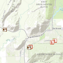
User count locations were selected to establish baseline information for consideration by all parties interested in improving the trail and pathway experience in the Jackson Hole area.
Our Methods and Data Sources paper provides greater details.
Locations were selected for a variety of reasons: because little is known about the extent of use and the mix of users; to answer questions about whether infrastructure is ‘right sized’ for the level and type of use; to determine if there is a clear pattern of use, such as time of day, direction of travel, or front country versus backcountry; and to inform current discussions about the need for changes in management based on use or its impacts.
The counts data are informative in what they say about where, how, and when people use trails and pathways in the region. A few findings are highlighted below.
Use and Proximity
During the winter and spring, trails and pathways use was distributed across the landscape. For example, nearby Cache Creek Road Mile 0 had a median of 189 users, but Emily’s Pond/Northeast Levee, though located further from population centers, had an even more users with 514.
In the summer and fall, trails and pathways closer to population centers see significantly more use. For example, nearby Summit trail had a median daily use of 305 people while a more remote trail such as Munger Mountain had a median daily use of 44 people.
Measuring the extent of use can demonstrate the areas most likely to experience future congestion or user conflicts. Resolving these issues will have a positive impact on a relatively large group of trails and pathways users.
Another important consideration is front country versus backcountry use. Comparing the number and location of shorter versus longer trips will allow local decision makers to better evaluate the importance of linkages or loops to create a variety of accessible travel options.
In addition, by maintaining the quality of front country experiences, there likely will be fewer impacts on the backcountry and more opportunities for solitude for those looking for that type of experience.
Type of Use
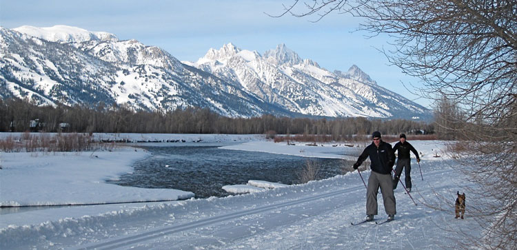
The types of use of the trails and pathways varied considerably during the winter and spring survey. For example, walkers were nearly 60 percent of users along Cache Creek Road Mile 0, and nearly 70 percent at Emily’s Pond Northeast Levee. But skiing and snowboarding also were quite popular—and the sole uses—at locations like Mt. Glory Bootpack and Mail Cabin.
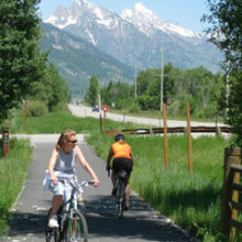
Walkers, mountain bikers, dog walkers and runners, and road bikers are the most common summer and fall users on area trails and pathways. People on foot outnumber those using wheeled devices. Wagon riders account for a significant amount of total use, but are limited to the first mile of Cache Creek and all commercial fees from the outfitter go toward trail maintenance.
In an example of the diversity of use, along the Arrow trail in the summer and fall 95 percent of the use was by mountain bikers while 92 percent of the use on Josie’s Ridge trail was by walkers, dog walkers and runners.
Pathways closer to Jackson such as Garaman had a balanced mix of users while pathway sections further from towns saw more road cycling—such as Path 22 – Skyline Tunnel with 80 percent road bike use.
Timing of Use
Weekends are generally busier than weekdays for all seasons. This was especially true of trails that are further from towns such as Munger Mountain and Fish Creek.
For winter and spring users, the use by time of day, generally was late morning to early afternoon. In the summer and fall, use varied quite a bit for different trails and pathways. Some, like Old Pass Road, were popular in the mornings. Others such as Hagen and Summit trails were commonly frequented in the middle of the day, and many such as Josie’s Ridge and Nelson Drive had a ‘rush hour’ after work in the early evening.
Understanding the timing of use pattern can help trail and pathway users know where to go when for a quieter experience. This is especially advantageous for places with heavy two-way traffic or a wide range of user types. Since pathways are designed for both recreation and transportation, ‘rush hour’ periods or heavy traffic may point to the need for improved sightlines, a widened paved surface, pullouts, or other methods to carry peak loads safely and efficiently.
Next Steps
This information provides one way to think about the return on investment in new or upgraded Jackson Hole’s trails and pathways, and to assist with keeping pace with demand for these resources and managing their impacts.
The LOR Foundation, whose goal is to enhance livability and quality of life in the Intermountain West through community-driven solutions, provided funding for this research to help communities better understand the use of trails and pathways, and to make informed choices about investing in and managing this infrastructure.