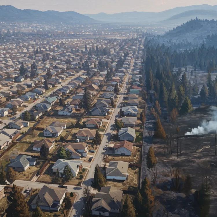
![](https://headwaterseconomics.org/wp-content/uploads/RuralCapacityMapHD-300x300.jpg)
A new map helps identify communities where investments in staffing and expertise are needed to support infrastructure and climate resilience projects.
Scott applies his skills with GIS and databases to gathering, manipulating, analyzing, and mapping socioeconomic data for Headwaters Economics. After moving to Montana from Sonoma County, CA, to conduct field research and go to graduate school, he realized that his true calling was the mountains, people, and wide-open spaces of the Rocky Mountain West. With an interest in biology and a knack for technology, Scott collected data on Ponderosa pine forests in central Idaho, mapped prairie dog communities, and examined the effects of fire on bird communities. At Headwaters he uses his experience with data technologies and tools to elucidate socioeconomic issues. Scott loves to hike, bike, and ski in the western landscapes whenever he has free time. He holds a M.S. in Biology from Montana State University.
While national poverty rates dropped in the last year, the county-level picture is mixed.
A new map helps identify communities where investments in staffing and expertise are needed to support infrastructure and climate resilience projects.
Find the latest American Community Survey data in all of our tools, including the Economic Profile System and Neighborhoods at Risk.
From 2000 to 2021, the number of single-family homes in Montana grew by more than 42 percent, and the popularity of large lots converted 1 million acres of undeveloped land to housing.
Millions of national park visitors generate economic opportunities for gateway communities, spending money that creates jobs and income. See the trends for every national park service unit.
At least 1.2 million wood roofs are in areas with wildfire risk. Funding is needed to help communities prepare for wildfire.