Despite recent snows, wildfires remain an enduring feature on the western landscape.
Given the rapid rise in suppression costs, along with increasing risks to homeowners and firefighters, now is the time to utilize preventative land use planning to implement practical solutions—reducing both costs and risks in the long-run.
Today, the impacts from climate change, coupled with ongoing development within the wildland-urban interface (WUI), is increasingly placing more lives and property at risk from wildfires. As a result, firefighting expenditures are soaring in order to protect homes, infrastructure, and crucial community assets from burning.
This past year was the most expensive wildfire season in history, with the U.S. Forest Service spending $1.7 billion on suppression costs alone.
 Equally alarming is the pace with which these appropriations have multiplied over the past two decades. For instance, wildfire suppression costs have risen from $160 million in 1985 to $367 million in 1995, and are projected to surpass $1.8 billion by 2025—that’s an increase of 365 percent during the past thirty years.
Unsurprisingly, as development within the WUI has grown–and as wildfires increase in size, severity, and frequency as a result of climate change–so too have risks and suppression costs. Today, a significant portion of the annual firefighting budget is spent on protecting homes and structures, particularly within wildfire-prone areas like the WUI.
In some places, like Austin, Texas, more than 25 percent of a community’s residential structures are considered at high wildfire risk due to their location within the WUI.
Given these escalating trends in firefighting costs, urban sprawl, and climate change, we need to explore alternative and more cost-effective approaches to reduce wildfire risks.
Headwaters Economics also is working with Wildfire Planning International to provide Community Planning Assistance for Wildfire (CPAW).
Wildfire Costs and Planning
Already five urban areas in the region are taking steps to mitigate wildfire risks through the perspective of land use planning.
While seemingly a simple solution, approaching wildfire risk reduction from a proactive and anticipatory land use planning lens is often overlooked. The successful implementation of these unique land use planning measures demonstrate the collaborative potential when homeowners, land agencies, and city officials work together to reduce community wildfire risk.
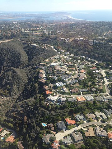
In San Diego, California for instance, the city enforces a comprehensive brush management policy on all homes situated within the WUI. Homeowners are required to thin vegetation within 100 feet of their homes, and if they don’t comply, the city charges them the costs for hiring a private contractor to perform the brush management.
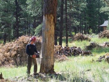
 In another example, residents of Flagstaff, Arizona decided to tax themselves in order to pay for a bond measure to fund fuels reduction projects within the city’s valued ponderosa pine forest. In recognizing the immediate threats from wildfires, Flagstaff residents successfully acted to protect forest health and nearby watershed resources.
Other cities in the West, including Austin, Texas, Boulder, Colorado, and Santa Fe, New Mexico also are using land use planning to effectively reduce wildfire risks. See “Land Use Planning to Reduce Wildfire Risk” for details.
