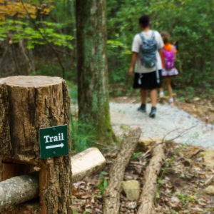
Trail use in the mountains and plateaus of Cibola and McKinley counties, New Mexico has been increasing in recent years, but trail managers lack data about where hiking, biking, and horseback riding occurs. Using a combination of infrared trail counters and statistical analyses, Headwaters Economics modeled trail use in the region and found nearly 83,000 visits to 140 miles of trails between March and August of 2023, equivalent to 4 in 5 residents using these trails in a six-month period. This research can help land managers and policy makers plan for the impacts of growing recreational use, prioritize investments in infrastructure, and tap into outdoor recreation for regional economic development.
The dashboard below allows users to identify the locations and timing of peak use in Cibola and McKinley counties from March through August 2023. Select a trail region or hover over a trail to see average monthly use. See data sources and methods below.

This analysis was conducted in partnership with the Cibola National Forest Mount Taylor Ranger District, the Northwest New Mexico Council of Governments, the Cibola Trails Alliance, the community of Grants, and the Continental Divide Trail Coalition.
Trends in Cibola & McKinley Counties
Lack of population and economic growth in recent years has piqued regional interest in promoting outdoor recreation as an economic development strategy. This study is the first time trail counts have been extensively measured. Among the key trends observed:
- Trail use is much greater than previously understood, with the equivalent of about 400 trail uses per day over a six-month period.
- Traffic peaks in May (approximately 23,000 uses) and June (approximately 20,000 uses).
- The McGaffey Trails show the greatest visitation with more than 44,000 uses. The Quartz Hill area, at the eastern end of the Zuni Mountains, saw 6,000 uses in six months, even while the trails were still being completed. Connecting these two areas via the Zuni Mountains Trail Partnership will likely increase use substantially in both areas.
Subscribe to our newsletter!
New methods of measuring trail use can help build a recreation economy
This analysis is part of Headwaters Economics’ growing body of work to improve methodology for measuring outdoor recreation so that more places have access to trail use data. Traditional methods of measuring trail use rely on periodic, single-point data collection, which is costly and labor-intensive to collect. Instead, the approach in this report uses on-the-ground counters to calibrate novel data sources like fitness-tracking apps, along with geographical and physical factors known to affect trail use (such as weather, distance from town, and air quality). A sophisticated statistical model is applied to estimate trail use across space and time.
Once the statistical model for a region is developed, it can be applied to additional trails in the region. The data can help agencies and communities make a stronger case for supporting the development of outdoor recreation resources. The analysis shown here is the first of a multi-phase project that will also measure the economic impact of trail use in the region and estimate year-round trail use.
Ongoing work will further evaluate the tradeoff between the accuracy of trail use estimates and the number of trail counters deployed. These kinds of insights will help recreation managers deploy trail counters strategically. The analyses presented here, scaled to all U.S. public lands, have the power to dramatically transform how outdoor recreation is developed and managed.
Data sources & methods
Headwaters Economics used data from infrared trail counters on 37 trails to fit several potential hierarchical generalized additive mixture models (HGAMs)—a statistical technique that allows for predictions across space and time; captures complex interplay between factors such as terrain, distance, user habits, and weather; and allows grouping by trail area.
We modeled the nonlinear functional relationships between covariates and counts of trail use, allowing the shape of the function itself to vary between designated trail areas while also incorporating a single common global smoother across all areas. We used the various model specifications to evaluate different spatial or temporal autocorrelation structures. Future work will explore approaches that can integrate both temporal and spatial autocorrelation.
Covariates include data obtained through partnerships with Strava Metro as well as trail-specific characteristics like driving distance to towns and time-varying characteristics like maximum temperature, precipitation, and air quality.
We deployed 14 infrared trail counters across the trail network between February 22, 2023, and August 30, 2023. Counters were deployed for a median of 165 days each, ranging from 18 to 190 days. On the 23 trails for which we did not have a trail counter installed, we estimated trail uses using the predictive statistical model. The median percent difference between actual monthly trail use and estimated trail use was 8.8%; the mean difference is 27.8%. For individual trails, the average percent difference ranged from 0% to 171%.
Infrared trail counters used to fit the model record a use each time the beam is broken and were installed to minimize inaccurate counts from dogs or vegetation. On a trail where use predominantly is out-and-back, the number of users will be approximately half of the total traffic.
Acknowledgments
This research was a collaborative effort by Headwaters Economics and Meridith Bartley, Ph.D., an independent statistical consultant. We would like to thank Carrie House with the Northwest New Mexico Council of Governments; Les Gaines, Chad Gaines, and Michael Brown of the Cibola Trails Alliance; and Brian Culligan and Brian Leddy of Adventure Gallup and Beyond for their assistance installing and monitoring the trail counters used in this study.