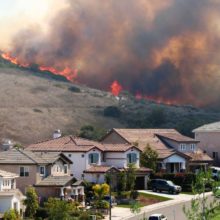
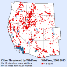
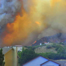
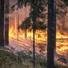
Wildfires across the American West are increasing in frequency, size, and severity. The impacts from climate change, coupled with ongoing development within the wildland-urban interface (WUI), further exacerbate the risks from wildfires. In response, some urban areas in the West are addressing the growing threat of wildfires using innovative land use planning tools.
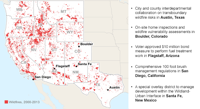
While each case study demonstrates a unique approach toward wildfire mitigation, together they represent a suite of land use planning strategies (Summary Table) that can be selectively applied elsewhere. To read the synopsis, see below or click on the Resources links to the right to read the full report and individual case study profiles.
Five Cities Using Innovative Land Use Planning Tools to Reduce Wildfire Risk
As described in a previous report, large and catastrophic wildfires are increasingly threatening urban areas, placing more lives and property at risk. As a result, some cities and communities in the region who have been repeatedly exposed to wildfires, are implementing creative land use planning strategies to mitigate these adverse effects.
Examples of wildfire risk reduction measures described below and in the full report demonstrate a community’s collaborative potential when local residents, city leaders, and land agencies combine resources to collectively manage wildfire risk. It is hoped this report provides a learning document for cities and towns across the West to see how other communities in the region are using land use planning to reduce wildfire risk.
The audiences for this report are planners and elected officials, firefighters, federal land managers and Members of Congress who can play a significant role in helping communities become better adapted to wildfire risk.
This project was funded through generous support from the Kresge Foundation.
Austin Summary
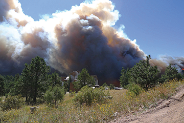 Austin, Texas is the fastest growing urban area in the country, with 1.8 million people living within the city and outlying suburbs. The city also ranks amongst the highest urban areas at-risk to wildfires, with more than 25 percent of its homes threatened by wildfire. The region’s burgeoning population is applying significant development pressure on the surrounding wildland-urban interface (WUI) and in particular, the Balcones Escarpment—a diverse landscape where the city’s foothills meets the prairies. Land use planning approaches to reduce wildfire risk must therefore consider unique ecological concerns and natural resource protection, together with long-term management of the WUI.
Similar to many urban areas in the West, Austin’s WUI extends beyond the city limits and into the larger jurisdiction of Travis County. Managing growth within the WUI, and other transboundary concerns such as wildfire mitigation, correspondingly presents significant challenges for both the City of Austin and Travis County. In response, close interdepartmental coordination between city personnel and county staff ensure that shared concerns related to the WUI are mutually addressed by both jurisdictions. For instance, a joint review of all proposed development within the WUI allows both the city and county an opportunity to require new development projects to integrate wildfire mitigation features into the design process, such as adequate water supplies, access routes, defensible space, hardening materials, and other wildfire risk reduction measures. In addition, the city and county recently formed a Joint Wildfire Task Force (JWTF) to collectively strategize and prepare communities for wildfires. A significant accomplishment of the JWTF was a combined Austin/Travis Community Wildfire Protection Plan in 2014, a document providing guidelines and best practices for managing wildfires within the WUI and surrounding area.
Boulder Summary
Boulder, Colorado is surrounded by vast public lands and natural amenities, making it a world-class recreational destination and one of Colorado’s most populated urban areas. Yet these same environmental attributes, such as nearby forests and grasslands, additionally expose the area’s communities to high wildfire risk.
The city and county of Boulder have consequently applied a progressive approach in managing the region’s rapidly expanding urban core alongside wildfire mitigation strategies. For instance, in an effort to conserve open space and natural resources, Boulder has implemented a comprehensive land management program to protect more than 100,000 acres from development. Such conservation practices reduce wildfire impacts by minimizing the presence of structures within the WUI, while at the same time preserving intact lands for recreational and aesthetic purposes.
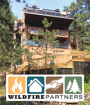 For homes in Boulder at risk to wildfires, a collaborative public-private partnership known as Wildfire Partners Program, performs on-site home inspections to reduce vulnerability from wildfire impacts. Wildfire Partners Program works with trained mitigation specialists to identify priority areas of risk and prevention strategies homeowners can implement to protect their property from wildfires. In addition, the program offers financial subsidies for contractors to complete the recommended mitigation work, provides resources and contacts related to wildfire activities, and conducts follow-up property inspections. For homeowners who successfully complete the Wildfire Partners Program, a certificate is awarded, which they can then send to their insurance company to verify compliance with wildfire preparedness practices.
Flagstaff Summary
Flagstaff, Arizona has a rich history of communities living alongside and adapting to wildfire threats. Situated within the largest contiguous ponderosa pine forest in the country, Flagstaff is prone to repeated wildfire events. Since the 1970s, local city leaders have been advocating for enhanced management of the ponderosa pine forests through fuels reduction projects and treatment work.
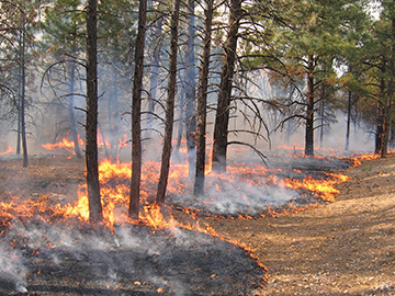 Such strong community support led to the establishment of the Greater Flagstaff Forest Partnership (GFFP), a unique partnership between land agencies, research institutions, and private organizations to enhance public awareness on issues related to forest health and wildfire impacts. As part of this collaborative effort, the GFFP facilitated the approval of the Flagstaff Watershed Protection Project, an ambitious $10 million bond measure to promote wildfire risk reduction measures and protect the city’s crucial watershed resources. Passed in 2012, the bond provides funds for prescribed burns and treatment work within city limits, as well as mitigation activities to minimize post-fire flooding impacts.
San Diego Summary
San Diego, California has experienced three of the top 20 largest and most severe wildfires in California history. Indeed, the Cedar Fire in 2003 and the Witch Fire in 2007 burned nearly 534,000 acres combined, killed 17 people, and devastated entire communities. As a result, San Diego has taken aggressive steps toward reducing wildfire risk within the city and surrounding area. This is a no easy task given the 500 linear miles of WUI skirting the city’s perimeter and the 42,000 properties contained within.
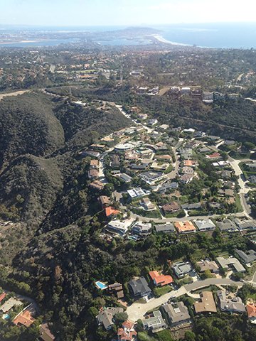 Yet San Diego’s Fire Department and county personnel are committed to working with the public to ensure mitigation measures are taken in order to protect homes and people from future wildfire events. One of the most ambitious efforts to reduce wildfire risk is the city’s broad brush management policy. For any properties containing habitable structures and native vegetation, the city requires vegetation treatment within 100 feet of the primary residence. The city conducts on-site inspections to monitor and track brush management requirements and homeowners that do not comply with the defensible space standards are billed the costs for hiring a private contractor to perform the treatment work on the property. In this way, individual homeowners are held responsible for reducing wildfire risks to their home and the community at large.
San Diego also works closely with California’s Department of Forestry and Fire Protection (CAL FIRE), which oversees wildfire prevention, education, and mitigation programs for the entire state. CAL FIRE provides a suite of fire-related resources for both the city and public, including current fire conditions and updates, safety procedures, grant opportunities, and post-fire recovery efforts. Together, the City of San Diego and CAL FIRE work to ensure mutual goals of open space management, structure protection, landscape restoration, safety standards, and other wildfire risk reduction measures are achieved.
Santa Fe Summary
Santa Fe, New Mexico is one of the earliest populated areas in the country, presenting a unique milieu of cultures, settlement patterns, and history. Proposed wildfire mitigation measures for the city must be balanced with several competing interests, such as protecting community aesthetic values, conserving open viewsheds, and preserving historic resources. As a result, Santa Fe has adopted innovative land use approaches to collectively address these priorities while at the same time, reducing wildfire risk. In particular, the city established an Escarpment Overlay District to protect critical habitat and open space located within Santa Fe’s escarpment, an area where the foothills climb sharply to meet the surrounding plateau. The overlay district sets standards for existing and new development situated within the escarpment and subjects these properties to more stringent wildfire protection regulations.
On-site inspections are performed for each proposed development within the escarpment overlay, ensuring new homes are appropriately equipped with water supplies, access routes, defensible space, and other wildfire mitigation features. To facilitate compliance with the overlay standards and associated wildfire protection practices, the city has hired an assessment specialist to work with developers and homeowners who want to build in the escarpment. In this way, development in the escarpment can still occur but it must adhere to certain preventative measures and mitigation practices that reduce the community’s overall risk to wildfires.

 For homes in Boulder at risk to wildfires, a collaborative public-private partnership known as
  Such strong community support led to the establishment of the
  Yet San Diego’s Fire Department and county personnel are committed to working with the public to ensure mitigation measures are taken in order to protect homes and people from future wildfire events. One of the most ambitious efforts to reduce wildfire risk is the city’s broad