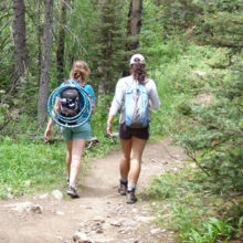
This map vizualization was produced as part of a larger partnership with Whitefish Legacy Partners and the Whitefish Convention and Visitors Bureau to understand the trail’s impact on local businesses and residents’ quality of life.
Methods: Estimating Trail Use
This visualization explores how to utilize “crowdsourced” data to help communities create economic opportunity and enhance quality of life for residents. Our goal was to evaluate how crowdsourced data could be used to engage community residents in projects that lead to better economic opportunity and health outcomes—for example, by encouraging participation in economic development projects, engaging residents in healthy outdoor recreation activities, and monitoring and demonstrating participation in ParksRx programs.
We investigated several platforms including Twitter, Flickr, Instagram, and Snapchat, and opted to develop this vizualization around a popular activity and fitness tracking app: Strava. Strava is a website and mobile app used to track athletic activity via satellite navigation. Strava data has been used in urban areas to help city planners improve bike routes and understand commuting patterns. We believe this application of Strava for the community of Whitefish, Montana is the first time, to our knowledge, Strava has been used in a more rural setting to estimate recreational trail use and related local economic benefits.
We partnered with the Whitefish Legacy Partners in Whitefish, Montana to collect data using in-person surveys and infrared (IR) trail counters at key trailheads in the developing system of trails known as The Whitefish Trail . Additionally, we received a grant from Strava Metro for Strava user data for the trail system for a concurrent time period and used it to compare to our IR counter and in-person survey data, as well as to extrapolate usage to parts of the trail system that were not surveyed directly.
Using Strava data calibrated to infrared counters, we were able to estimate trail and pathway use in Flathead County by user type (local or tourist) and activity type (pedestrian vs. bike). These estimates are part of a larger project with local partners to understand the benefits of trail use on local businesses and residents’ quality of life.
The Strava data enabled us to generate comprehensive estimates of trail use for the entire county (rather than only certain locations where we deployed infrared trail counters). The Strava-based data and visualization that we developed will be used by our local partners to support their trail network, which we demonstrated to be an economic asset to the community. Our approach to using Strava for estimating trail use is replicable in other communities and is substantially less expensive than estimating trail use and benefits using traditional analyses based entirely on local survey data.
Detailed Methods (PDF)
Additional Trails Research and Tools
To help community leaders, elected officials, trail users, and others better understand these benefits—and determine whether a trail project meets community priorities—Headwaters Economics has created a number of user-friendly tools:
- These Whitefish, MT maps show recreational, visiting users, and local economic trail impacts.
- This visualization work shows summer and winter trail use around Jackson, Wyoming.
- Our Trails Benefits Library, with more than 130 studies on trails, is searchable by impact, use, year, and region.
- Access to trails is a crucial issue, as shown in this Taos, New Mexico study.
- In Bonner County, Idaho, we surveyed residents to help prioritize future work based on usage, satisfaction, reasons for living in the area, and suggestions for improvement.